
Here you can find and compare the widest variety of quality sporting equipment. For family and hobby sports or intensive, personal workout and endurance sports. Plus the proper clothing and accessories to get just what you need at a price that fits your budget.
Sports gear and apparel for all sizes, all sports and all seasons. This shop has equipment for every sports activity. You'll find the right gear to enjoy your favorite sports. Find your specialized sports apparel and accessories here too. Better than just finding what you want. Here you can compare prices, brands and stores and get the best price for your favorite brand.
Sports gear and apparel for all sizes, all sports and all seasons. This shop has equipment for every sports activity. You'll find the right gear to enjoy your favorite sports. Find your specialized sports apparel and accessories here too. Better than just finding what you want. Here you can compare prices, brands and stores and get the best price for your favorite brand.
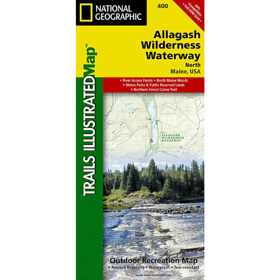
Nat Geo Allagash Wilderness Waterway North Trail Map
National Geographic's recreational maps of the Allagash Wilderness Waterway are two-sided, waterproof maps designed to meet the needs of outdoor enthusiasts and tourists alike. . The Allagash Wilderness Waterway North map details the far northern reaches of the waterway on the Canadian border south to Churchill Lake. The front or north side of the map includes the area stretching from the Fort Kent State historic site on the Saint John River south to Saint Froid Lake. Also includes the Saint Francis, Fish, and Allagash Rivers, and the northern portion of Eagle Lake. The south side of the map shows Long Lake, Umsaskis Lake, the five Musquacook lakes, Spider Lake, and Pleasant Lake. A UTM and latitude/longitude grid, as well as compass rose and scale bar will keep you pointed in the right direction. Divided into two separate maps for exceptional detail, each is loaded with valuable information such as watercraft regulations, rules for recreational use and access, river difficulty scale, checkpoints, visitor and ranger station locations, and more. Location of scenic viewpoints, wildlife viewing, boat launches and canoe carry downs, lookout towers, amphitheaters, ATV trails, and other points of interest are clearly marked as are park and forest boundaries and access points. Campers will appreciate the attention paid to noting the variety of camping facilities available including primitive campsites, group campsites, rental cabins, RV camping, picnic shelters, restrooms, parking, and trailheads. Folded 4.5 x 9.25 in., Fully opened 26 x 38 in.. Scale: 1:63,360 / Nat Geo Allagash Wilderness Waterway North Trail Map
Extra 20% Off on Clearance at EMS!
Price:
$0.00 from
Sold by
Product Name
Price